- The Summer Drum Circle in Vancouver
- Lower Antelope Canyon – Expectation Vs. Reality
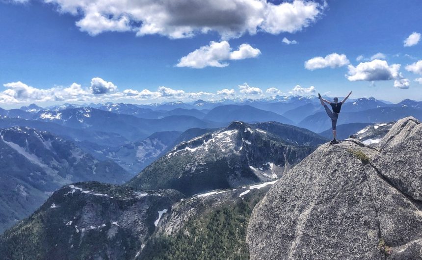
- St Mark’s Summit Hike in Vancouver
- Joffre Lakes Hike Near Whistler
- Garibaldi Lake Hike Near Whistler
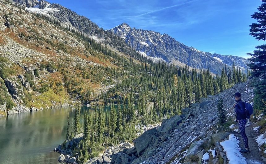
- The Mystical Watersprite Lake Hike in Squamish
- Wedgemount Lake and Glacier Hike In Whistler
- Iceberg Lake Hike in Whistler
- Kokanee Lake Hike in Nelson
- Needle Peak Hike Near Vancouver
- How To Stay Safe in Mexico (Without Staying at a Resort)
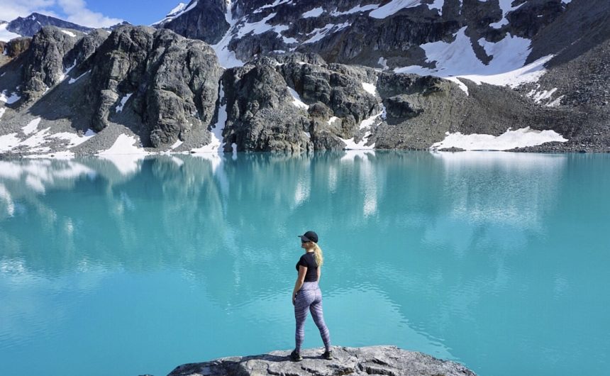
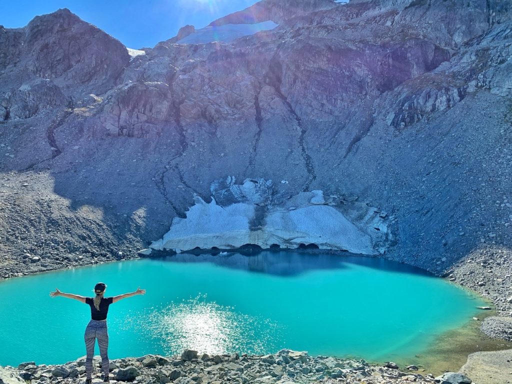
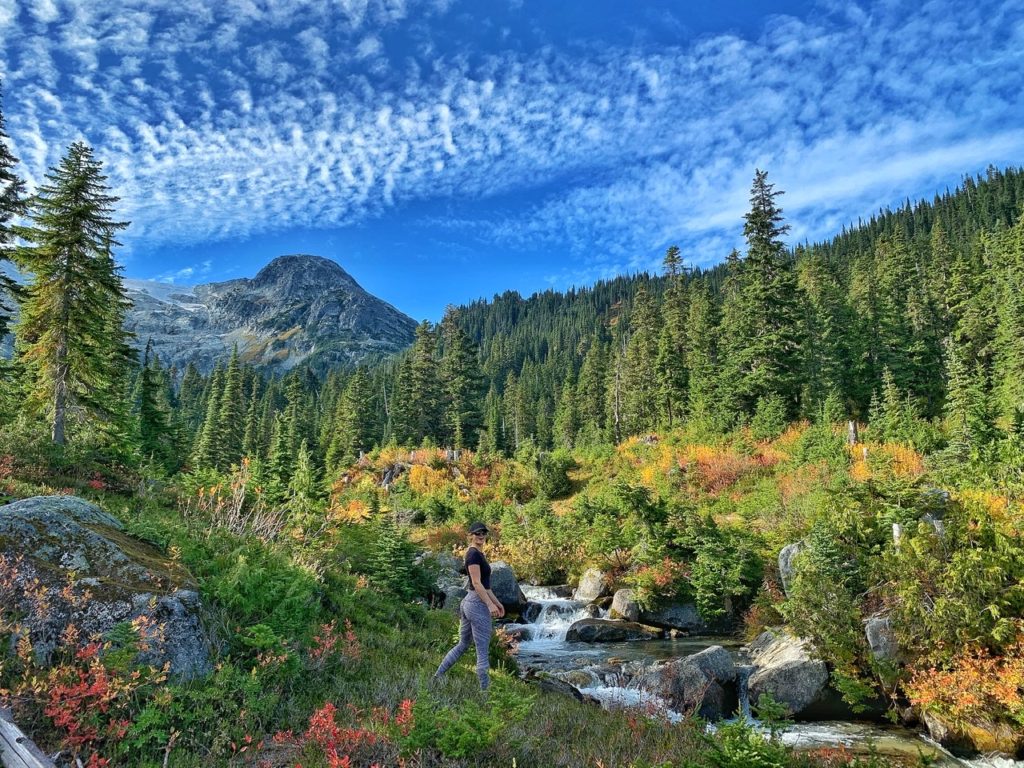
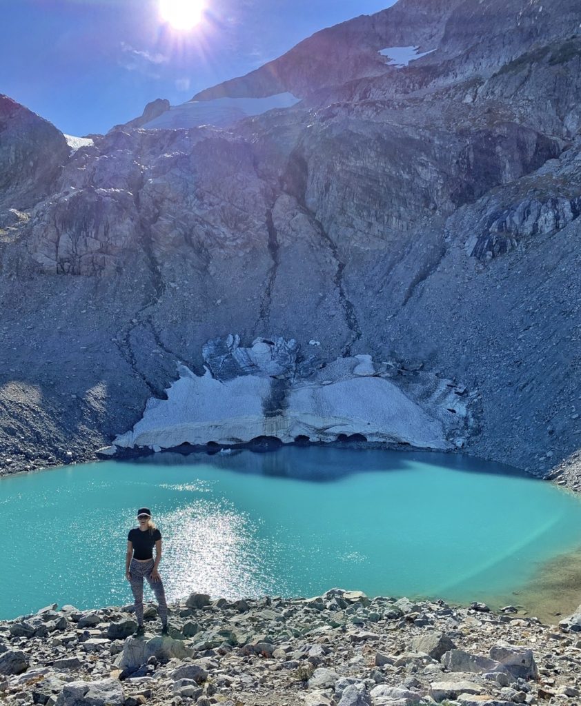
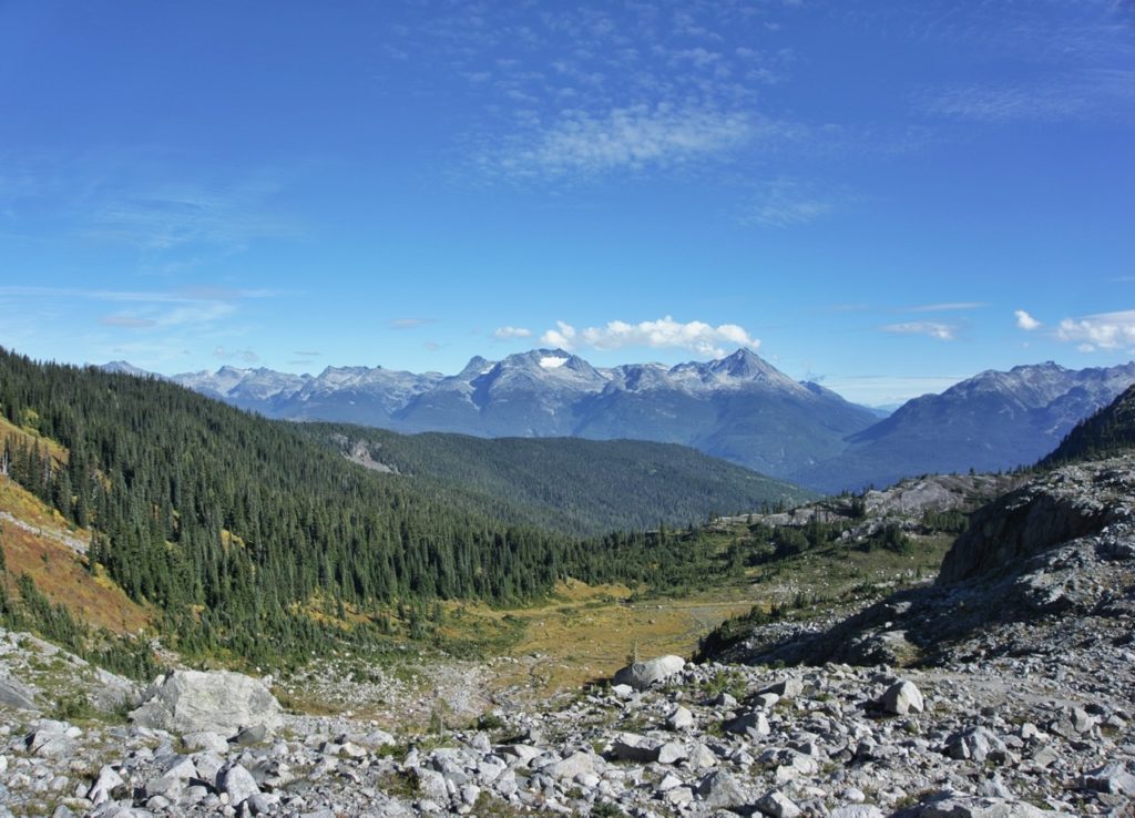
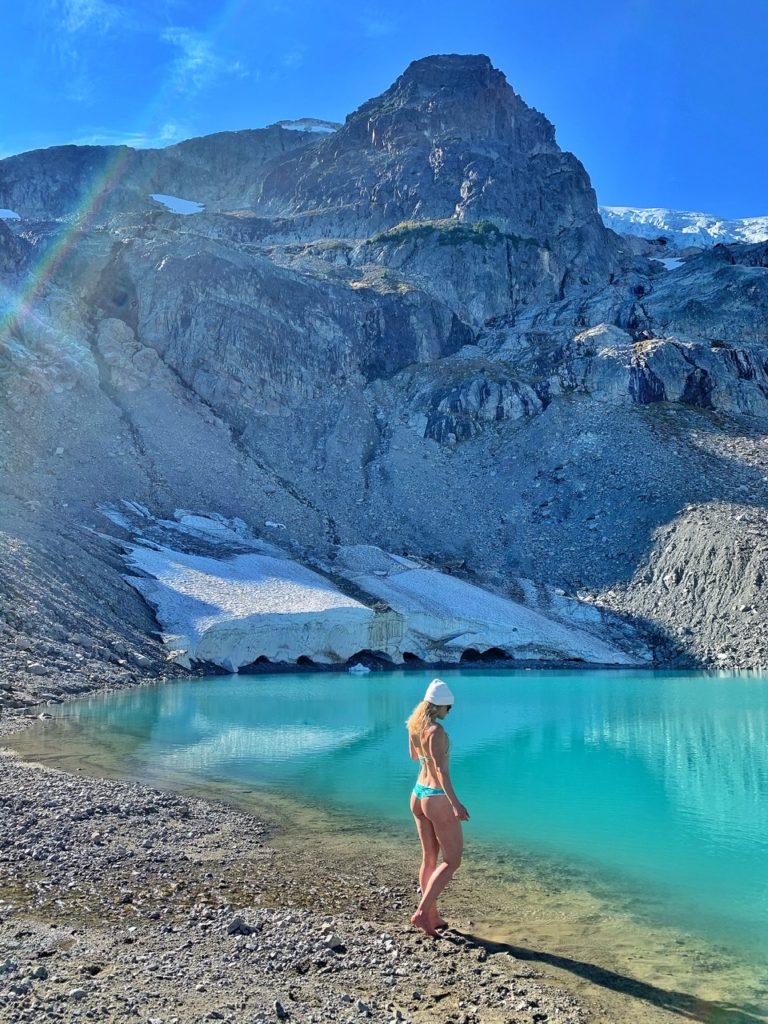
Iceberg Lake is a popular day hike in Whistler that follows a scenic forested trail high into the alpine, into a spectacular meadow, and then finishes at a beautiful turquoise alpine lake surrounded by impressive glaciers. If you hike early enough in the season, you’ll see mini icebergs from the glacier floating around the lake.
THE STATS
Difficulty – Intermediate
Hiking time – 6-7 hours
Roundtrip – 15km
Elevation Gain – 870m
Summit altitude – 1628m
Season – July to October-ish
Camping – No
From Vancouver – 2 hours
Public Transit – Yes/No
Dog Friendly – No
Trail type – Out and back
THE HIKE
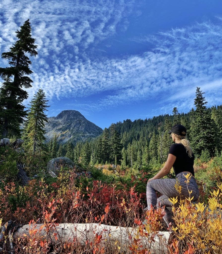
A friend and I hiked to Iceberg Lake on October 7th during a fall heat wave of 20C+ (however, it snowed a week later, so October is a wild card for weather). It was the perfect time to go because it was warm, there were only a few other hikers on a weekday and the fall colors were absolutely stunning! The beautiful scenery and all the lovely fall colors easily made Iceberg Lake one of my favorite hikes.
However, because it was so late in the season, there was only one little, lonely iceberg left at the lake, so if you want to see icebergs, you have to hike in July or August (and also deal with the ruthless and unmerciful gangs of mosquitoes). But the lake is always a beautiful turquoise.
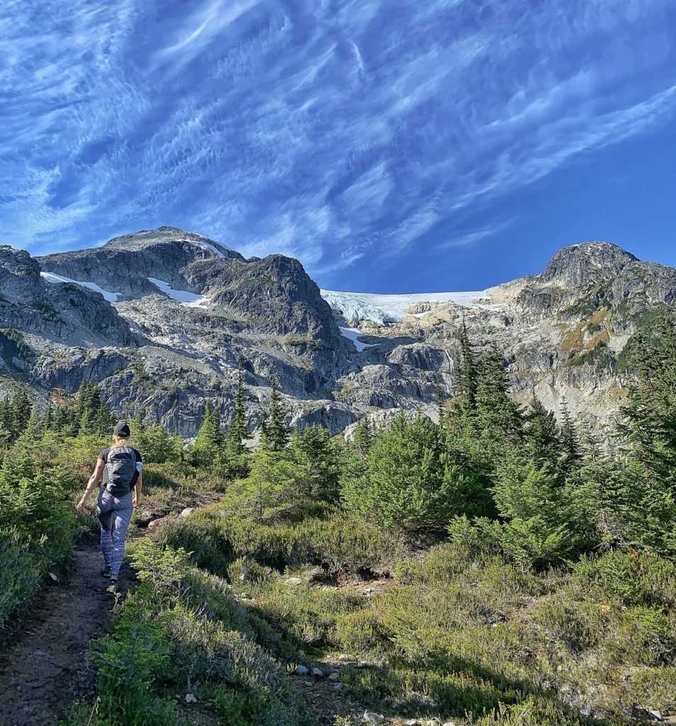
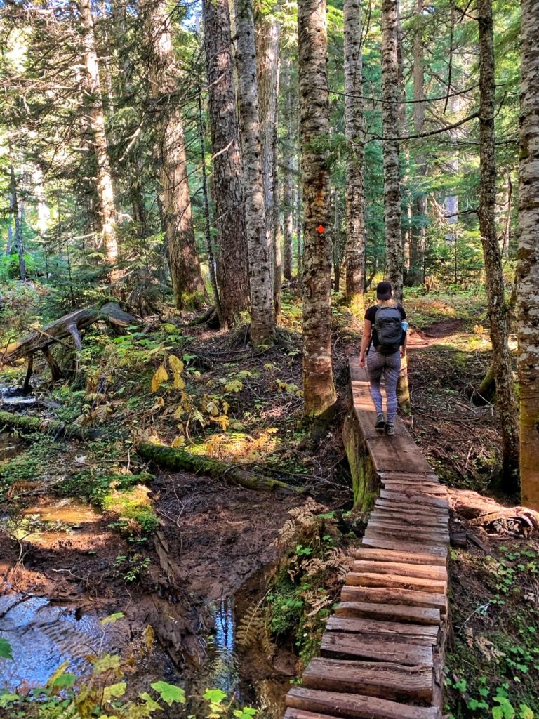
The majority of the hike is in the forest until you reach the scenic meadow.
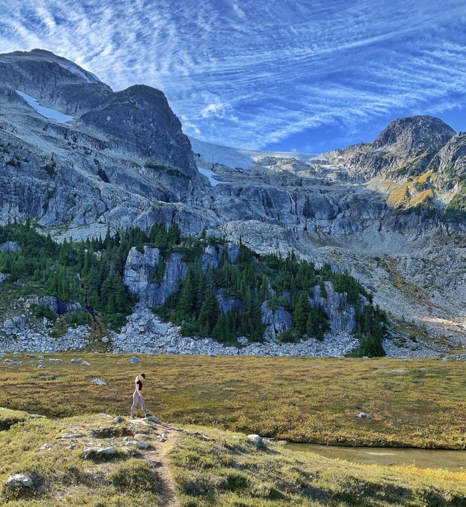
The final hike from the meadow to Iceberg Lake is up a steep boulder field. But it’s all worth it because the views are seriously incredible!
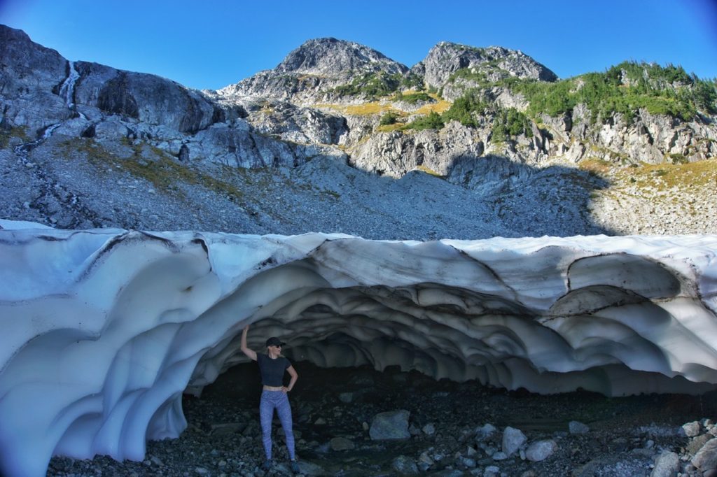
Take a brave dip in the lake and explore around the glaciers and ice caves before retracing your steps back to the trail.
NEED TO KNOW
Grizzly bear encounters are not uncommon on the Iceberg Lake trail, therefore solo hiking is not recommended. Sometimes parts of the trail are closed due to bear activity, so be sure to check in advance. Hike with at least one friend, make noise, bring bear spray and be informed about what to do if you see a bear. See here on how to handle a grizzly encounter. Luckily, we didn’t see any bears on our hike.
There’s a pile of hiking sticks on the left where the trail begins. It’s a good idea to take one if you didn’t bring hiking poles because the first few kilometres of the hike are steep.
Due to the accessibility of the hike to Whistler, this is a popular hike, so if possible, try to avoid weekends or get there very early.
Explore the ice caves in the glaciers with caution as they can collapse.
There is an outhouse near the meadow.
There aren’t any garbage facilities, so take your garbage with you.
Camping and dogs are not permitted at Iceberg Lake. This is likely for safety reasons due to the grizzly bear activity.
WHAT YOU NEED
- Bring layers, even on a warm day
- Swimsuit and towel
- Wear and bring sunscreen. The sun is stronger at higher elevation.
- More water and food than you think you’ll need
- Bug spray
- Toilet paper and hand sanitizer
- Maps.me is an app for offline maps and it’s great for hiking trails
- Remember to stretch before and after!
HOW TO GET THERE
From Vancouver, it’s around a 2 hour drive to the trailhead. The trail starts in a residential area near the Sea to Sky highway about 5km after Whistler Village. There is street parking, but pay close attention to the parking signs or you will get ticketed.
From the cul-de-sac at the top of Mountain View Drive, walk past the wooden sign board and turn left immediately at the trail sign for Lower 19 Mile Creek. Follow the trail uphill to the gravel road, then turn left and walk up the gravel road for about 40m and watch for a sign on the right of the road. Follow the trail on the right, which goes up to another gravel logging road, then cross this second road and follow the steep bank into the forest.
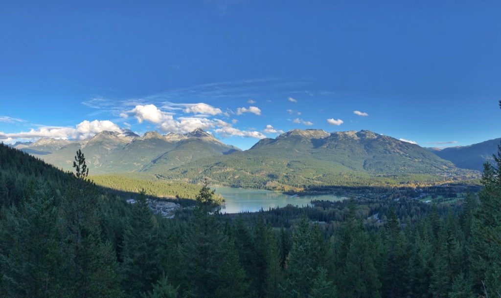
Keep following the trail. After a steep climb, you’ll arrive at a sign pointing to a viewpoint to the left where you can see a beautiful view overlooking Green Lake.
Keep your eye on the orange markers and the 19 Mile Creek trail signs that will lead you to Iceberg Lake.
I highly recommend Maps.me for the hiking trail because it works offline and it tells you how far you have left to hike.
MORE HIKES IN THE AREA
Garibaldi Lake – Another hike to a larger alpine lake
Joffre Lakes – An easier and shorter hike that visits 3 turquoise alpine lakes
Watersprite Lake – A mystical alpine lake
Wedgemount Lake – A very challenging, but rewarding hike to a turquoise alpine lake and glacier