- The Summer Drum Circle in Vancouver
- Lower Antelope Canyon – Expectation Vs. Reality
- St Mark’s Summit Hike in Vancouver
- Joffre Lakes Hike Near Whistler
- Garibaldi Lake Hike Near Whistler
- The Mystical Watersprite Lake Hike in Squamish
- Wedgemount Lake and Glacier Hike In Whistler
- Iceberg Lake Hike in Whistler
- Kokanee Lake Hike in Nelson
- Needle Peak Hike Near Vancouver
- How To Stay Safe in Mexico (Without Staying at a Resort)
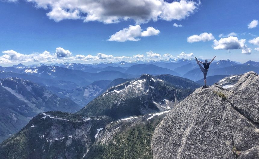
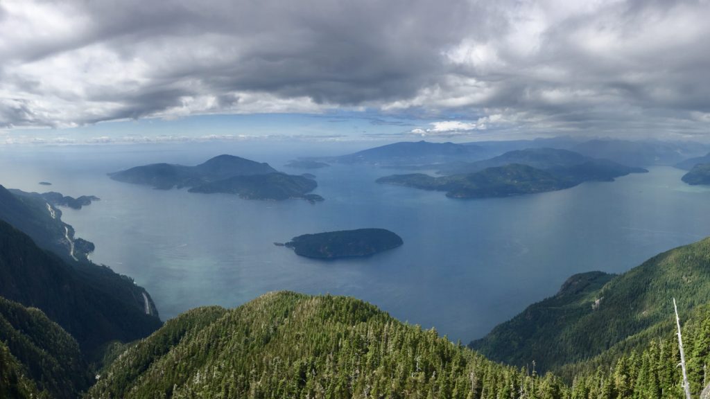
St. Mark’s Summit is a peak along the Howe Sound Crest Trail that offers spectacular views of Howe Sound on a sunny and clear summer day in Vancouver.
THE STATS
Difficulty – Intermediate
Hiking time – 3.5-5 hours
Roundtrip – 11km
Elevation Gain – 460m
Summit altitude – 1371m
Season – July to October
Camping – No
From Vancouver – 45 minutes
Shuttle Service – Parkbus
Dog friendly – On leash
Trail type – Out and back
THE HIKE
The hike to St. Mark’s Summit is 11km roundtrip with an elevation gain of 460m. Your total hike time will be around 3.5-5 hours roundtrip, depending on your fitness level, plus the time spent at the summit and the Bowen Island viewpoint, near the beginning of the hike. Six friends and I finished the hike in about 4 hours, including the stop at the Bowen Island viewpoint and the summit.

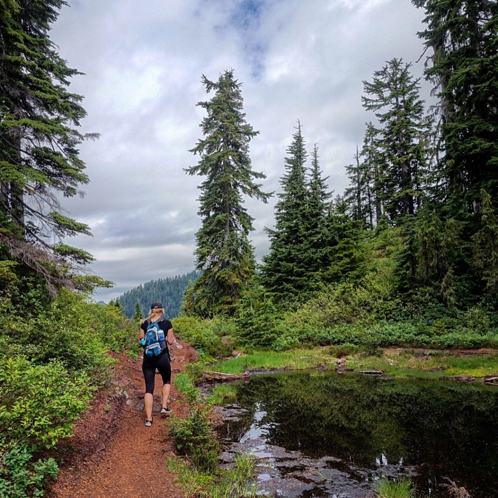
I hiked in mid-August and while it was a little cooler at elevation, you definitely get very warm as you hike. Luckily, most of the hike is in shaded tree cover to protect from the sun.
On a clear day at St Mark’s Summit, you can see views of Howe Sound, the Tantalus Range, and even the Gulf Islands and Vancouver Island in the distance.
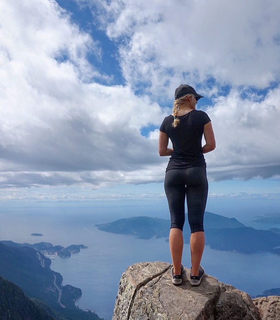
There are a few great viewpoints at the summit, where you’ll be greeted by some friendly critters looking for snacks. The birds and chipmunks are very tame because they’ve gotten used to people feeding them.

The hike to St Mark’s Summit is a good half day commitment and it’s best on a sunny day in July to October. Some clouds are fine, but an overcast day will likely result in a disappointing view. Because St Mark’s Summit is an accessible hike, both physically and location-wise, it’s a very popular hike so it can get busy on weekends. I went on a Tuesday in August, which wasn’t busy at all, but if weekends are your only option, make sure you get there early, unless you don’t mind a crowded trail.
NEED TO KNOW
There are proper toilets in the parking lot, but there aren’t any facilities at the summit. Take your garbage with you.
WHAT YOU NEED
- Bring and wear sunscreen.
- Lots of water, lunch and snacks.
- Bug spray. There weren’t many mosquitoes when I hiked in August, but there was an insane amount of black flies. I didn’t think they were the biting type, but I ended up with a few really nasty bites that appeared later on.
- Bring layers. Even on a hot day, it could be chilly at the top at nearly 1400m.
- Maps.me is an app for offline maps and it’s great for hiking trails.
- Remember to stretch before and after!
HOW TO GET THERE
The drive to Cypress Mountain in West Vancouver is about 45 minutes from Vancouver, depending on traffic, and the hike starts from the northernmost parking lot at Cypress Mountain.
From the parking lot, head north towards the nearby chairlift and look for the Howe Sound Crest Trail sign. The trail follows alongside several ski runs until a sign points to the right to the Howe Sound Crest Trail. Follow the trail uphill until it merges onto a wider ski run and turn left towards the large green water tower. Just before the tower, turn right onto a trail and walk uphill through the trees. After a short hike, you’ll arrive at a gravel road where you will go left and continue a short distance until the road narrows and becomes the Howe Sound Crest Trail, which will take you to St Mark’s Summit. Later on, there will be a series of switchbacks to the summit.
Happy hiking!